|
ઝામ્બેસી નદી બે દેશો વચ્ચે ની સરહદ છે. દક્ષિણમાં ઝીમ્બાબ્વે અને ઉત્તર માં ઝામ્બિયા. અર્વાચીન અવતાર પહેલા એક દેશ નોર્થ રોડેશિયા અને બીજો સાઊથ રોડેશિયા ના નામે જણાતા હતા.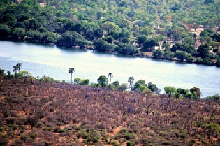 Victoria Falls ધોધ નું નામ અને જીમ્બાબ્વે બાજુ ના શહેર નું પણ નામ. ધોધ પહેલા નદી નો વિશાળ પટ છે, અને ધોધ ની ભેખડો ની હારમાળા પણ વિસ્તૃત છે. પણ પાણી પડે તે ખાઈ ઘણી ઊંડી અને રૂંધ છે. પાણી પડતાં અને પડી ને ગીચ વાછટ નું વાદળ બની પાછી ઊંચે આવે, અને પવન ના ઝૉકે ધોધ જોવા આવેલા સહેલાણી ને ઝીમ્બાબ્વે કિનારા પર આવેલા પાર્ક માં ભીંજાવે. ખાઈ લાંબી અને વળાંક વાળી છે, અને એક દેશ થી બીજે જતો રસ્તો એક પૂલ પરથી પસાર થાય. સરહદ પુલ ની વચ્ચે! પણ કોઈ કારણસર એક મીટર લાંબો પૂલ નો ભાગ ના ઘરનો કે ઘાટનો. એને ઝીમઝામ કહેવાય છે! ઉત્તર કિનારે 15 કી.મી દૂર ઝામ્બિયા નું લિવિંગસ્ટન શહેર આવ્યું, અને એરપોર્ટે ત્યાં જ છે. એ બાજુ નદી અને ધોધ ના ઉપલા કિનારે છેક પાણી અને ધોધ ની અણી સુધી જવાય, અને વેગ ઓછો હોય ત્યારે સાવ કિનારી પર મોટું ખાબોચિયું છે, જેમાં સહેલાણિયો જંપલાવી શકે – છીછરું હોય ત્યારે! Victoria Falls ધોધ નું નામ અને જીમ્બાબ્વે બાજુ ના શહેર નું પણ નામ. ધોધ પહેલા નદી નો વિશાળ પટ છે, અને ધોધ ની ભેખડો ની હારમાળા પણ વિસ્તૃત છે. પણ પાણી પડે તે ખાઈ ઘણી ઊંડી અને રૂંધ છે. પાણી પડતાં અને પડી ને ગીચ વાછટ નું વાદળ બની પાછી ઊંચે આવે, અને પવન ના ઝૉકે ધોધ જોવા આવેલા સહેલાણી ને ઝીમ્બાબ્વે કિનારા પર આવેલા પાર્ક માં ભીંજાવે. ખાઈ લાંબી અને વળાંક વાળી છે, અને એક દેશ થી બીજે જતો રસ્તો એક પૂલ પરથી પસાર થાય. સરહદ પુલ ની વચ્ચે! પણ કોઈ કારણસર એક મીટર લાંબો પૂલ નો ભાગ ના ઘરનો કે ઘાટનો. એને ઝીમઝામ કહેવાય છે! ઉત્તર કિનારે 15 કી.મી દૂર ઝામ્બિયા નું લિવિંગસ્ટન શહેર આવ્યું, અને એરપોર્ટે ત્યાં જ છે. એ બાજુ નદી અને ધોધ ના ઉપલા કિનારે છેક પાણી અને ધોધ ની અણી સુધી જવાય, અને વેગ ઓછો હોય ત્યારે સાવ કિનારી પર મોટું ખાબોચિયું છે, જેમાં સહેલાણિયો જંપલાવી શકે – છીછરું હોય ત્યારે!
અમે ઝીમ્બાબ્વે ના ભાગમાં રહ્યા, કારણકે ધોધ ત્યાંથી જ દેખાય! આખો દિવસ ફર્યા, ભીના થયા, સુકાયા અને ડબલ મેઘધનુષ (પેલી ઊંધી ફરતી વાછટ ના વાદળ માં) વારંવાર જોયા. બીજે દિવસે પાછું ઝીમ્બાબ્વે તરફથી અડધા કલ્લાક ની હેલિકોપ્ટર રાઇડ માટે ગયા. ઉપરથી શું દ્રષ્ય દેખાય! આખો ધોધ, વાછટ નું આખું વાદળ,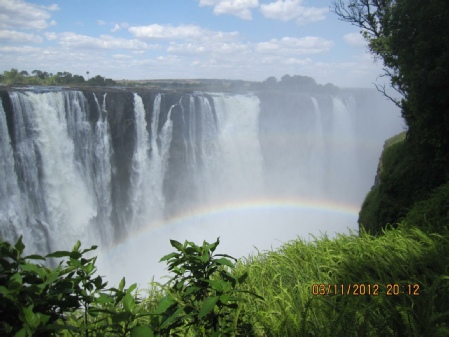 મેઘધનુષ, અને નદી ધોધ પહેલા અને પછી ખાઈ અને ખીણ માં રૂંધ થઈ ને તોફાની બનતી. પછી હેલિકોપ્ટર જંગલ તરફ ફેરવ્યું, અને ઉપર થી હાથી અને જિરાફ ના ટોળાં જોયા. મને હેલિકોપ્ટરમાં ચાલક ની બાજુ ની સીટ મળી હતી, અમે 4 જ જણ હતા. બારી ખોલવા દીધી, અને tele-lens લગાડી ખુલ્લી બારીમાં થી ધડાધડ ફોટા પાડ્યા! શું મજા આવી છે. અંજુને પણ બારી મળી હતી. મેઘધનુષ, અને નદી ધોધ પહેલા અને પછી ખાઈ અને ખીણ માં રૂંધ થઈ ને તોફાની બનતી. પછી હેલિકોપ્ટર જંગલ તરફ ફેરવ્યું, અને ઉપર થી હાથી અને જિરાફ ના ટોળાં જોયા. મને હેલિકોપ્ટરમાં ચાલક ની બાજુ ની સીટ મળી હતી, અમે 4 જ જણ હતા. બારી ખોલવા દીધી, અને tele-lens લગાડી ખુલ્લી બારીમાં થી ધડાધડ ફોટા પાડ્યા! શું મજા આવી છે. અંજુને પણ બારી મળી હતી.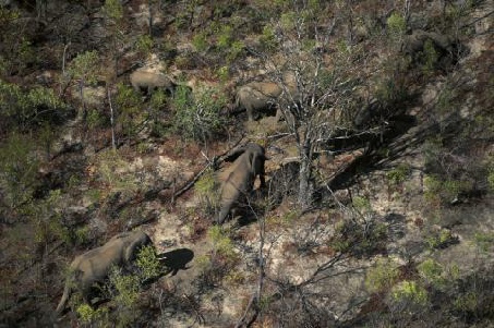 ત્યારબાદ, સરહદ અને ઝીમઝામ પાર કરી લીવિંગસ્ટોન ના એરપોર્ટે થી ફ્લાઇટ પકડી એક બદલી કરી Richards Bay પહોંચ્યા. રાત રહી ગયા, અને સવાર પડતાં ગાડી કરી સેંટ લૂચિયા. ત્યારબાદ, સરહદ અને ઝીમઝામ પાર કરી લીવિંગસ્ટોન ના એરપોર્ટે થી ફ્લાઇટ પકડી એક બદલી કરી Richards Bay પહોંચ્યા. રાત રહી ગયા, અને સવાર પડતાં ગાડી કરી સેંટ લૂચિયા.
નાનું અમસ્તું ગામ છે, એક મોટો રસ્તો અને બે ત્રણ નાની ગલીઓ. અને સેંટ લૂચિયા ની ખાડી નો કિનારો. આ ખાડી સેંટ લૂચિયા નામના સરોવર સુધી જાય, પણ એ સરોવર દરિયા ના પાણી નું છે, દરિયાનો ભૂલો પડેલો ભાગ! સવારે જ પહોંચી ગયા, એટલે બપોરે સેંટ લૂચિયા ખાડીમાં ફરવા લઈ જતી બોટ માં રિવર સફારી કરવા નીકળ્યા. બોટ માં નીચે બેસવાની વ્યવસ્થા, અને પહેલે માળે અગાશી. અમે બંને તો સિધ્ધા અગાશી માં પહોંચ્યા.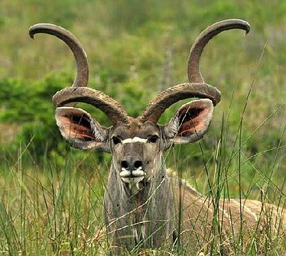 ખાસ તો આ ખાડીમાં હિપ્પો ઘણા છે, અને બે જુવાનિયા હિપ્પો રમત કરતાં જોવા મળ્યા. બોટ પાસે ગઈ પણ એ બે ગેલ કરતા જ રહ્યા. બોટ ના એક ગાઇડ ના હાથમાં અમને હિપ્પો નો આગલો દાંત બતાવ્યો. ૧૪ ઇંચ લાંબો, ૧ ઇંચ થી વધારે વ્યાસ, અને ૩ કિલો જેવુ વજન! પેલા ભાઈ બધાને કહેતા જાય, “ભારી છે, સંભાળજો!” બીજે દિવસે, Isimangoliso અભય અરણ્યમાં ગાડીમાં ફરવા માંડ્યુ. વિસ્તાર લાંબો, અને ઝાડી બટકી, વચ્ચે ખુલ્લા ઘાસ ના મેદાન, અને ૩-૪ જાતનાં હરણ. હિપ્પો થોડા મળ્યા પણ હિંસક પ્રાણી એક પણ નહીં. પક્ષીઓ ઘણા. આબોહવા જરા ઘેરાયેલી હતી, અને Indian Ocean નો કિનારો તોફાની હતો. રસ્તો વારંવાર દરિયા ને કિનારે કે પછી સેંટ લૂચિયા સરોવર ને કિનારે. દ્રષ્ય સુંદર, પણ wildlife જૂજ. ગેંડા જોવા મળ્યા, પાસેથી. ગેંડાની પસલી પર જૂનો જખમ દેખાતો હતો, અને રસ્તા થી માંડ 30 ફૂટ દૂર હતો. ગાડી ઊભી રાખી એંજિન ચાલુ, અને અમારા હ્રદય ના ધબકારા શાંત પડ્યા પછી ફોટા! ઝીબ્રા જરા દૂર હતા, પણ vervet વાંદરા, જંગલી ભેંસ અને કુડુ મળ્યા. એક કુડુ નર, પૂર્ણ શૃંગાર માં – ભરાવદાર શિંગડા – અને પાછળ માદા નું ઝૂન્ડ- મળ્યા. સાંજે ગામમાં ફરતા હતાં ત્યારે એક પટ્ટાવાળા નોળિયા સહકુટુંબ જોવા મળ્યા. ખાસ તો આ ખાડીમાં હિપ્પો ઘણા છે, અને બે જુવાનિયા હિપ્પો રમત કરતાં જોવા મળ્યા. બોટ પાસે ગઈ પણ એ બે ગેલ કરતા જ રહ્યા. બોટ ના એક ગાઇડ ના હાથમાં અમને હિપ્પો નો આગલો દાંત બતાવ્યો. ૧૪ ઇંચ લાંબો, ૧ ઇંચ થી વધારે વ્યાસ, અને ૩ કિલો જેવુ વજન! પેલા ભાઈ બધાને કહેતા જાય, “ભારી છે, સંભાળજો!” બીજે દિવસે, Isimangoliso અભય અરણ્યમાં ગાડીમાં ફરવા માંડ્યુ. વિસ્તાર લાંબો, અને ઝાડી બટકી, વચ્ચે ખુલ્લા ઘાસ ના મેદાન, અને ૩-૪ જાતનાં હરણ. હિપ્પો થોડા મળ્યા પણ હિંસક પ્રાણી એક પણ નહીં. પક્ષીઓ ઘણા. આબોહવા જરા ઘેરાયેલી હતી, અને Indian Ocean નો કિનારો તોફાની હતો. રસ્તો વારંવાર દરિયા ને કિનારે કે પછી સેંટ લૂચિયા સરોવર ને કિનારે. દ્રષ્ય સુંદર, પણ wildlife જૂજ. ગેંડા જોવા મળ્યા, પાસેથી. ગેંડાની પસલી પર જૂનો જખમ દેખાતો હતો, અને રસ્તા થી માંડ 30 ફૂટ દૂર હતો. ગાડી ઊભી રાખી એંજિન ચાલુ, અને અમારા હ્રદય ના ધબકારા શાંત પડ્યા પછી ફોટા! ઝીબ્રા જરા દૂર હતા, પણ vervet વાંદરા, જંગલી ભેંસ અને કુડુ મળ્યા. એક કુડુ નર, પૂર્ણ શૃંગાર માં – ભરાવદાર શિંગડા – અને પાછળ માદા નું ઝૂન્ડ- મળ્યા. સાંજે ગામમાં ફરતા હતાં ત્યારે એક પટ્ટાવાળા નોળિયા સહકુટુંબ જોવા મળ્યા.
બીજે દિવસે અમે વહેલી સવારે નીકળી લૂલુવ્હે (HluHluwe) wildlife reserve ફરવા ગયા. અહીં બેશિંગી ગેંડા મળશે એવું વાંચેલું. આખા પાર્ક માં અમારી ગાડીમાં જ ફરાય એવી વ્યવસ્થા હતી, પણ એવો હુકમ પણ હતો કે અમુક જગ્યા સિવાય, રસ્તામાં કશે પણ ગાડી માં થી નીચે ઊતરવું નહીં. દિવસ ને અંતે પાછા ફરવાની ફેરવી માં હતા, અને એક ઢાળ પર રસ્તો ચઢતો હતો, અને અમે ગાડી ધીમે ધીમે ચલાવતા હતા, ત્યાં સામે રસ્તા પર be જબ્બર ગેંડા શાંતિ થી ચરતા હતા. ગાડી ઊભી તો રાખી પણ એં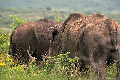 જિન ચાલુ કે સામો થયો અને ભગવું પડે તો તૈયાર. પાર્ક વાળા એ દરેક ગાડી ના ડ્રાઇવર ને ખાસ શીખવેલું, પાર્ક માં અંદર જવા દીધા પહેલા. ધીમેથી ડ્રાઇવર ની બાજુ ની બારી ખોલી, અંજુ બને એટલું પાછળ દબાઈને બેઠી, અને મારો કેમેરો ચાલ્યા જ કર્યો. પેલા બે થોડી વારે ઉંધા ફર્યા, અમને એમ કે જશે, પણ ત્યાં રહ્યા, પાછા અમારી તરફ મોઢું કર્યું, ધડ ધડ સંભળાયું – પણ એ તો અમારા જ ધબકારા હતા! દોઢેક ફૂટ લાંબું અને તીણિ નોચ વાળું શિંગડું અને અમારે ગાડી કરતાં મોટું કદ. ગેંડા ભાઈ ના તો સામા થયા ના તો અમારી સામે જોયું તો ખરું, પણ કઈ પરવા કરી. ફરી ને જંગલ તરફ ગયો, અને ચરવા માંડ્યો. રસ્તા થી માંડ ૫૦ફૂટ દૂર હતા – આ બે! અમે ગેંડા વ્યૂ માં ઊભા રહ્યા, બંને સાહેબો ચરતા ચરતા ઝાડી માં ઘૂસી ગયા ત્યાં સુધી. પછી ઘર ભેગા. જિન ચાલુ કે સામો થયો અને ભગવું પડે તો તૈયાર. પાર્ક વાળા એ દરેક ગાડી ના ડ્રાઇવર ને ખાસ શીખવેલું, પાર્ક માં અંદર જવા દીધા પહેલા. ધીમેથી ડ્રાઇવર ની બાજુ ની બારી ખોલી, અંજુ બને એટલું પાછળ દબાઈને બેઠી, અને મારો કેમેરો ચાલ્યા જ કર્યો. પેલા બે થોડી વારે ઉંધા ફર્યા, અમને એમ કે જશે, પણ ત્યાં રહ્યા, પાછા અમારી તરફ મોઢું કર્યું, ધડ ધડ સંભળાયું – પણ એ તો અમારા જ ધબકારા હતા! દોઢેક ફૂટ લાંબું અને તીણિ નોચ વાળું શિંગડું અને અમારે ગાડી કરતાં મોટું કદ. ગેંડા ભાઈ ના તો સામા થયા ના તો અમારી સામે જોયું તો ખરું, પણ કઈ પરવા કરી. ફરી ને જંગલ તરફ ગયો, અને ચરવા માંડ્યો. રસ્તા થી માંડ ૫૦ફૂટ દૂર હતા – આ બે! અમે ગેંડા વ્યૂ માં ઊભા રહ્યા, બંને સાહેબો ચરતા ચરતા ઝાડી માં ઘૂસી ગયા ત્યાં સુધી. પછી ઘર ભેગા.
બીજે દિવસે પાછા Richards Bay એરપોર્ટે, અને સિધ્ધા Johannesburg ની ફ્લાઈટ લઈ ત્યાં પહોંચ્યા. ત્યાં મારો એક મિત્ર સ્થાયી થયો છે, એને ઘરે. એનું એક ફાર્મ છે, Trout river falls – લીડનબર્ગ પાસે આવ્યું. એણે અમારી એ ફાર્મ પર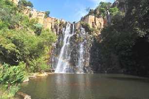 જવાની વ્યવસ્થા કરેલી. ગાડી અને ડ્રાઈવર પણ મોકલ્યો! મે હા પાડી ત્યારે ખ્યાલ નહીં કે ફાર્મ જોહાનસબર્ગ થી ૩૫૦ કી.મી. દૂર છે! મપુમલાંગા નામ નો વિસ્તાર છે. ફાર્મ પર રિસોર્ટ બનાવ્યું છે, અને એક કોટેજ માં અમે. બીજે દિવસે અમે બ્લાઈડ નદી ની ખીણ (Blyde River Canyon) થઈ ને આ પ્રદેશ નું ચક્કર માર્યું. પેનેરોમિક રુટ કહેવાય તે. એક વ્યૂ પોઈન્ટ થી બ્લાઈડ નદી, એના પર બ્લાઈડસ્પૂર નામ નો બંધ, અને એનાથી બનેલા સરોવર ની વચ્ચે એક એકલું અટુલું પણ ૨૦૦૦ ફૂટ ઊંચું શિખર. આજુબાજુ ડુંગરાળ પ્રદેશ, અને ખાસ તો ત્રણ શિખરની ત્રિપુટી - ઢેકા જેવા શિખર (Three Rondavel) જે આ પ્રદેશના સ્થાયી પ્રજાના ગામ માં ઝૂંપડી હોય તે આકારના. Rondavel શબ્દ એ ઘર ની ઢબ ને માટે વપરાય છે. દંત કથા એવી છે કે સરોવર ની વચ્ચે શિખર છે તે ગામ નો મુખિયો છે, અને પેલી ત્રિપુટી એની ત્રણ પત્નીઓ. આગળ એવું જ વિશાળ દ્રષ્ય દેખાય એવી પહાડની કિનારી છે, જેને દૈવીબારી – god’s window કહેવાય છે. બુર્ક નામનો એક કમનસીબ સોનું શોધવા એક નદી ની ભેખડો પાસે ખાણ ખોદી, પણ મળ્યું હરિબટ્ટો! (આ શબ્દ મારા પપ્પા નો મનગમતો શબ્દ હતો) પણ એ માણસ નું અનુમાન એના ગયા પછી સાચું નિવડ્યું. એટલે બુર્ક નું નસીબ એવો આ જગ્યા નું નામ પડ્યું. ટ્રુર નામની નદી પહાડ માં થી નીકળી બ્લાઈડ નદી ને મળે છે, જાણે બ્લાઈડ નો ઉદ્ભવ જ અહીં થી થતો હોય તેમ. ભૂમિ ના તત્ત્વ જેમતેમ ખવાઇ ને અવનવા આકારો કોતરાયા છે, અને પાણી એમાંથી ધસે! રાત પાછી ટ્રાઊટ ફોલ્સ માં કાઢી, અને સવારે સિધ્ધા જોહનેસબર્ગ ના એરપોર્ટ પર, અને સિંગાપુર ની ફ્લાઇટ માં! જવાની વ્યવસ્થા કરેલી. ગાડી અને ડ્રાઈવર પણ મોકલ્યો! મે હા પાડી ત્યારે ખ્યાલ નહીં કે ફાર્મ જોહાનસબર્ગ થી ૩૫૦ કી.મી. દૂર છે! મપુમલાંગા નામ નો વિસ્તાર છે. ફાર્મ પર રિસોર્ટ બનાવ્યું છે, અને એક કોટેજ માં અમે. બીજે દિવસે અમે બ્લાઈડ નદી ની ખીણ (Blyde River Canyon) થઈ ને આ પ્રદેશ નું ચક્કર માર્યું. પેનેરોમિક રુટ કહેવાય તે. એક વ્યૂ પોઈન્ટ થી બ્લાઈડ નદી, એના પર બ્લાઈડસ્પૂર નામ નો બંધ, અને એનાથી બનેલા સરોવર ની વચ્ચે એક એકલું અટુલું પણ ૨૦૦૦ ફૂટ ઊંચું શિખર. આજુબાજુ ડુંગરાળ પ્રદેશ, અને ખાસ તો ત્રણ શિખરની ત્રિપુટી - ઢેકા જેવા શિખર (Three Rondavel) જે આ પ્રદેશના સ્થાયી પ્રજાના ગામ માં ઝૂંપડી હોય તે આકારના. Rondavel શબ્દ એ ઘર ની ઢબ ને માટે વપરાય છે. દંત કથા એવી છે કે સરોવર ની વચ્ચે શિખર છે તે ગામ નો મુખિયો છે, અને પેલી ત્રિપુટી એની ત્રણ પત્નીઓ. આગળ એવું જ વિશાળ દ્રષ્ય દેખાય એવી પહાડની કિનારી છે, જેને દૈવીબારી – god’s window કહેવાય છે. બુર્ક નામનો એક કમનસીબ સોનું શોધવા એક નદી ની ભેખડો પાસે ખાણ ખોદી, પણ મળ્યું હરિબટ્ટો! (આ શબ્દ મારા પપ્પા નો મનગમતો શબ્દ હતો) પણ એ માણસ નું અનુમાન એના ગયા પછી સાચું નિવડ્યું. એટલે બુર્ક નું નસીબ એવો આ જગ્યા નું નામ પડ્યું. ટ્રુર નામની નદી પહાડ માં થી નીકળી બ્લાઈડ નદી ને મળે છે, જાણે બ્લાઈડ નો ઉદ્ભવ જ અહીં થી થતો હોય તેમ. ભૂમિ ના તત્ત્વ જેમતેમ ખવાઇ ને અવનવા આકારો કોતરાયા છે, અને પાણી એમાંથી ધસે! રાત પાછી ટ્રાઊટ ફોલ્સ માં કાઢી, અને સવારે સિધ્ધા જોહનેસબર્ગ ના એરપોર્ટ પર, અને સિંગાપુર ની ફ્લાઇટ માં!
|
The 4th longest African river, Zambesi is a border between many a country. An interesting one is between two parts of the old Rhodesia. South became Zimbabwe, and North became Zambia, and their border at Victoria Falls is what we saw. There is a bridge across the ravine immediately after the waters of the Zambesi fall off the Chasm named after England’s second most famous Queen – Victoria. There is a meter long stretch of the bridge that belongs to neither country, and is known as ZimZam! The town on the Zimbabwe side is also known as Victoria Falls, and the Zambia side town – Livingstone is a few Km. away. To see the water tumbling down, and raising the cloud of mist which gives it it’s African name, (Mosi-oa-Tunya, "The Smoke That Thunders” in the local Lozi dialect) you have to go to the p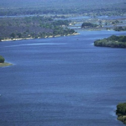 ark on the Zimbabwe side, and to swim in a little pool at the very edge of the waterfall, you have to go to the Zambian side. Boat ride on the Zambesi river, or a helicopter ride over the falls, Zimbabwe side! ark on the Zimbabwe side, and to swim in a little pool at the very edge of the waterfall, you have to go to the Zambian side. Boat ride on the Zambesi river, or a helicopter ride over the falls, Zimbabwe side!
We spent the first day in the park, going from one end to the other, getting wet in the spray which flies up and back, drying off, getting wet again, and seeing a double rainbow almost on demand! The next day began with a helicopter ride – the 30 minute one – Wow, what a perspective! I had the seat next to the pilot, with a window next to me that I was allowed to open. I had to hold down my tele-lens a bit inside the window so that it would not get knocked aside by the wind! But it was non-stop clicking! 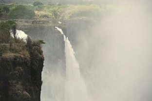 Anju too had a window seat, sharing the rear seat with two others. Just the four of us in the chopper. After multiple swings over the waterfall, right side, left, north south traverse and return, the pilot took us over the forest and we saw herds of giraffe and elephants from the air. The forest was relatively thin of foliage because it was just the beginning of spring in the southern hemisphere, and we had a clear view of the ground. We finished the ride, packed up, and off to Livingstone to take a one hop flight to Richards Bay on the Indian Ocean coast of South Africa. We stayed there overnight, picked up our car the next morning, and drove down to St. Lucia about 90 Km. away. Anju too had a window seat, sharing the rear seat with two others. Just the four of us in the chopper. After multiple swings over the waterfall, right side, left, north south traverse and return, the pilot took us over the forest and we saw herds of giraffe and elephants from the air. The forest was relatively thin of foliage because it was just the beginning of spring in the southern hemisphere, and we had a clear view of the ground. We finished the ride, packed up, and off to Livingstone to take a one hop flight to Richards Bay on the Indian Ocean coast of South Africa. We stayed there overnight, picked up our car the next morning, and drove down to St. Lucia about 90 Km. away.
St. Lucia is a village really, with a main street along the St. Lucia estuary, which finally leads to the ST. Lucia lake of brackish water. The Isimangoliso Wetland Park lies between the lake and the Indian Ocean. That evening we took a cruise on the estuary. The boat had a terrace and many of us crowded up top, to see the hippos in the estuary. A sight to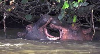 remember was a couple of “youngsters” playing or fighting near the bank, completely indifferent to how close the boat came to them. One of the guides on the boat had a hippo’s front tooth in his hand– over 14 inches long, just over an inch in diameter and may be 3 kilos in weight! He had to warn people who wanted to hold it, that it was heavy and they should brace properly! Families of hippos in the calm but muddy water. remember was a couple of “youngsters” playing or fighting near the bank, completely indifferent to how close the boat came to them. One of the guides on the boat had a hippo’s front tooth in his hand– over 14 inches long, just over an inch in diameter and may be 3 kilos in weight! He had to warn people who wanted to hold it, that it was heavy and they should brace properly! Families of hippos in the calm but muddy water.
Next morning, we took off into the Isimangoliso Wetland Park. Overcast skies, almost no traffic other than us, long drive to the other end of the park, but few wildlife except a gorgeous kudu bull with a fabulous set of horns. We did not see any of the other marine wildlife, a few hippos a bit far away compared to the boat cruise the previous evening, and plenty of birds. Plenty of kudu, Vervet monkeys, cape buffalo and zebras in the distance. We did see a couple of rhino’s quite close to the road. One of them had an old would on his flank, and a large cloud of insects was hitching a ride on him (could have been a her too, we did not know!), and that was the highlight of the day! The area is beautiful, and while my camera did not like the overcast conditions, it did make for a cool ride. 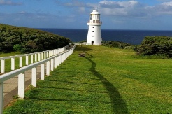 We encountered a gang of banded mongoose in the park behind the residences of the town, which was an entertaining sight. We walked out to the beach behind the town, saw lots of terns and gulls. We encountered a gang of banded mongoose in the park behind the residences of the town, which was an entertaining sight. We walked out to the beach behind the town, saw lots of terns and gulls.
The next morning saw us heading to Hluhluwe-Imfolozi park. African rhino is what we had missed all along, and this was where we were hoping to see it. We could take our car in and drive around, but there was discipline to be observed, and the rangers briefed all of the drivers, before letting us in. Wild buffalo in herds, fishing eagle, a variety of deer’s, warthogs and then just when we finally turned towards home, the rhino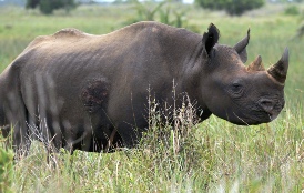 encounter – right next to the road on a slope, two of them in all their mud and insect covered glory with a 18 inch sharp as needle fore horns, and each one almost as large as the car! The second horn is set behind the front one, and is generally blunt. We stopped dead, but kept the engine on as advised by the rangers in their gate briefing. After our heart beats settled a bit, we lowered driver side window, Anju sat back as far as she could, and I kept on clicking through the window. The two ambled around grazing lazily, looked at us, decided “no trouble”, and resumed their wandering. Both rhino sightings were thrilling – the day before in Isimangoliso and this day in Hluhluwe. Home that evening, and back to Richards Bay the next morning, and in Johannesburg at my friend’s house there. A walled compound with razor wire on top of a 12 foot wall –life in Jo’burg. encounter – right next to the road on a slope, two of them in all their mud and insect covered glory with a 18 inch sharp as needle fore horns, and each one almost as large as the car! The second horn is set behind the front one, and is generally blunt. We stopped dead, but kept the engine on as advised by the rangers in their gate briefing. After our heart beats settled a bit, we lowered driver side window, Anju sat back as far as she could, and I kept on clicking through the window. The two ambled around grazing lazily, looked at us, decided “no trouble”, and resumed their wandering. Both rhino sightings were thrilling – the day before in Isimangoliso and this day in Hluhluwe. Home that evening, and back to Richards Bay the next morning, and in Johannesburg at my friend’s house there. A walled compound with razor wire on top of a 12 foot wall –life in Jo’burg.
My friend had planned a trip for us to his farm in the Mpumalanga province, near the Drakensberg range, and near the border with the Limpopo province, near the town of Lydenburg called Trout River Falls Farm.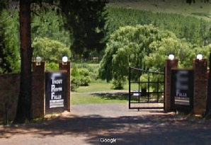 What I did not know was that it was almost 350 Km from Jo’burg. But he gave us his car and driver, and off we went to a beautiful cottage with a water fall at the back, and rolling hills in front. There is a drive called the Panorama Route, and that is what we did the next day. Blyde river canyons, and the Three Rondavel view point, followed by Burke’s Luck potholes, God’s Window, Grasskop and back. Blyde river area is very scenic. We climb to a plateau about 700 meters up, and the canyons and valleys are laid out below us. From the Rondavel view point, we could see a vast panorama with the lake formed by the Blydespoor dam. There is a towering peak rising from the middle of the lake, and three similar towers to the east of this lake. These three are the Rondavel – a word used to describe the native hut common in this region and large parts of South Africa. What I did not know was that it was almost 350 Km from Jo’burg. But he gave us his car and driver, and off we went to a beautiful cottage with a water fall at the back, and rolling hills in front. There is a drive called the Panorama Route, and that is what we did the next day. Blyde river canyons, and the Three Rondavel view point, followed by Burke’s Luck potholes, God’s Window, Grasskop and back. Blyde river area is very scenic. We climb to a plateau about 700 meters up, and the canyons and valleys are laid out below us. From the Rondavel view point, we could see a vast panorama with the lake formed by the Blydespoor dam. There is a towering peak rising from the middle of the lake, and three similar towers to the east of this lake. These three are the Rondavel – a word used to describe the native hut common in this region and large parts of South Africa.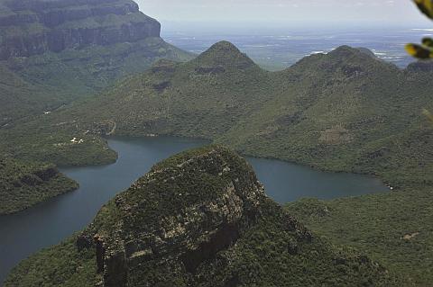 The story is that the peak in the middle of the lake is the village chief, and three rondavel on the shore are his three wives! God’s Window was another panorama filling up the horizon with green and the occasional blue! Burke was a gold miner, who staked a claim near the place that now bears his name. He did not find any gold, but his contention that there was gold in the area turned out to be true. Grasskop the town nearby is indeed a gold mining town. But the potholes are a series of holes and shapes eroded in the bedrocks of the Trur river, as it falls into the Blyde river, almost as if Blyde rises here. The shapes and depth of the erosion is rather spectacular. Quite a popular tourist and local picnic spot. Home that evening to Trout River Falls, and directly to the Jo’burg airport and the flight to Singapore. The story is that the peak in the middle of the lake is the village chief, and three rondavel on the shore are his three wives! God’s Window was another panorama filling up the horizon with green and the occasional blue! Burke was a gold miner, who staked a claim near the place that now bears his name. He did not find any gold, but his contention that there was gold in the area turned out to be true. Grasskop the town nearby is indeed a gold mining town. But the potholes are a series of holes and shapes eroded in the bedrocks of the Trur river, as it falls into the Blyde river, almost as if Blyde rises here. The shapes and depth of the erosion is rather spectacular. Quite a popular tourist and local picnic spot. Home that evening to Trout River Falls, and directly to the Jo’burg airport and the flight to Singapore.
|

 Victoria Falls ધોધ નું નામ અને જીમ્બાબ્વે બાજુ ના શહેર નું પણ નામ. ધોધ પહેલા નદી નો વિશાળ પટ છે, અને ધોધ ની ભેખડો ની હારમાળા પણ વિસ્તૃત છે. પણ પાણી પડે તે ખાઈ ઘણી ઊંડી અને રૂંધ છે. પાણી પડતાં અને પડી ને ગીચ વાછટ નું વાદળ બની પાછી ઊંચે આવે, અને પવન ના ઝૉકે ધોધ જોવા આવેલા સહેલાણી ને ઝીમ્બાબ્વે કિનારા પર આવેલા પાર્ક માં ભીંજાવે. ખાઈ લાંબી અને વળાંક વાળી છે, અને એક દેશ થી બીજે જતો રસ્તો એક પૂલ પરથી પસાર થાય. સરહદ પુલ ની વચ્ચે! પણ કોઈ કારણસર એક મીટર લાંબો પૂલ નો ભાગ ના ઘરનો કે ઘાટનો. એને ઝીમઝામ કહેવાય છે! ઉત્તર કિનારે 15 કી.મી દૂર ઝામ્બિયા નું લિવિંગસ્ટન શહેર આવ્યું, અને એરપોર્ટે ત્યાં જ છે. એ બાજુ નદી અને ધોધ ના ઉપલા કિનારે છેક પાણી અને ધોધ ની અણી સુધી જવાય, અને વેગ ઓછો હોય ત્યારે સાવ કિનારી પર મોટું ખાબોચિયું છે, જેમાં સહેલાણિયો જંપલાવી શકે – છીછરું હોય ત્યારે!
 મેઘધનુષ, અને નદી ધોધ પહેલા અને પછી ખાઈ અને ખીણ માં રૂંધ થઈ ને તોફાની બનતી. પછી હેલિકોપ્ટર જંગલ તરફ ફેરવ્યું, અને ઉપર થી હાથી અને જિરાફ ના ટોળાં જોયા. મને હેલિકોપ્ટરમાં ચાલક ની બાજુ ની સીટ મળી હતી, અમે 4 જ જણ હતા. બારી ખોલવા દીધી, અને tele-
 ત્યારબાદ, સરહદ અને ઝીમઝામ પાર કરી લીવિંગસ્ટોન ના એરપોર્ટે થી ફ્લાઇટ પકડી એક બદલી કરી Richards Bay પહોંચ્યા. રાત રહી ગયા, અને સવાર પડતાં ગાડી કરી સેંટ લૂચિયા.
  ખાસ તો આ ખાડીમાં હિપ્પો ઘણા છે, અને બે જુવાનિયા હિપ્પો રમત કરતાં જોવા મળ્યા. બોટ પાસે ગઈ પણ એ બે ગેલ કરતા જ રહ્યા. બોટ ના એક ગાઇડ ના હાથમાં અમને હિપ્પો નો આગલો દાંત બતાવ્યો. ૧૪ ઇંચ લાંબો, ૧ ઇંચ થી વધારે વ્યાસ, અને ૩ કિલો જેવુ વજન! પેલા ભાઈ બધાને કહેતા જાય, “ભારી છે, સંભાળજો!” બીજે દિવસે, Isimangoliso અભય અરણ્યમાં ગાડીમાં ફરવા માંડ્યુ. વિસ્તાર લાંબો, અને ઝાડી બટકી, વચ્ચે ખુલ્લા ઘાસ ના મેદાન, અને ૩-
 જિન ચાલુ કે સામો થયો અને ભગવું પડે તો તૈયાર. પાર્ક વાળા એ દરેક ગાડી ના ડ્રાઇવર ને ખાસ શીખવેલું, પાર્ક માં અંદર જવા દીધા પહેલા. ધીમેથી ડ્રાઇવર ની બાજુ ની બારી ખોલી, અંજુ બને એટલું પાછળ દબાઈને બેઠી, અને મારો કેમેરો ચાલ્યા જ કર્યો. પેલા બે થોડી વારે ઉંધા ફર્યા, અમને એમ કે જશે, પણ ત્યાં રહ્યા, પાછા અમારી તરફ મોઢું કર્યું, ધડ ધડ સંભળાયું – પણ એ તો અમારા જ ધબકારા હતા! દોઢેક ફૂટ લાંબું અને તીણિ નોચ વાળું શિંગડું અને અમારે ગાડી કરતાં મોટું કદ. ગેંડા ભાઈ ના તો સામા થયા ના તો અમારી સામે જોયું તો ખરું, પણ કઈ પરવા કરી. ફરી ને જંગલ તરફ ગયો, અને ચરવા માંડ્યો. રસ્તા થી માંડ ૫૦ફૂટ દૂર હતા – આ બે! અમે ગેંડા વ્યૂ માં ઊભા રહ્યા, બંને સાહેબો ચરતા ચરતા ઝાડી માં ઘૂસી ગયા ત્યાં સુધી. પછી ઘર ભેગા.
  જવાની વ્યવસ્થા કરેલી. ગાડી અને ડ્રાઈવર પણ મોકલ્યો! મે હા પાડી ત્યારે ખ્યાલ નહીં કે ફાર્મ જોહાનસબર્ગ થી ૩૫૦ કી.મી. દૂર છે! મપુમલાંગા નામ નો વિસ્તાર છે. ફાર્મ પર રિસોર્ટ બનાવ્યું છે, અને એક કોટેજ માં અમે. બીજે દિવસે અમે બ્લાઈડ નદી ની ખીણ (Blyde River Canyon) થઈ ને આ પ્રદેશ નું ચક્કર માર્યું. પેનેરોમિક રુટ કહેવાય તે. એક વ્યૂ પોઈન્ટ થી બ્લાઈડ નદી, એના પર બ્લાઈડસ્પૂર નામ નો બંધ, અને એનાથી બનેલા સરોવર ની વચ્ચે એક એકલું અટુલું પણ ૨૦૦૦ ફૂટ ઊંચું શિખર. આજુબાજુ ડુંગરાળ પ્રદેશ, અને ખાસ તો ત્રણ શિખરની ત્રિપુટી -
 ark on the Zimbabwe side, and to swim in a little pool at the very edge of the waterfall, you have to go to the Zambian side. Boat ride on the Zambesi river, or a helicopter ride over the falls, Zimbabwe side!
  Anju too had a window seat, sharing the rear seat with two others. Just the four of us in the chopper. After multiple swings over the waterfall, right side, left, north south traverse and return, the pilot took us over the forest and we saw herds of giraffe and elephants from the air. The forest was relatively thin of foliage because it was just the beginning of spring in the southern hemisphere, and we had a clear view of the ground. We finished the ride, packed up, and off to Livingstone to take a one hop flight to Richards Bay on the Indian Ocean coast of South Africa. We stayed there overnight, picked up our car the next morning, and drove down to St. Lucia about 90 Km. away.
 remember was a couple of “youngsters” playing or fighting near the bank, completely indifferent to how close the boat came to them. One of the guides on the boat had a hippo’s front tooth in his hand– over 14 inches long, just over an inch in diameter and may be 3 kilos in weight! He had to warn people who wanted to hold it, that it was heavy and they should brace properly! Families of hippos in the calm but muddy water.
 We encountered a gang of banded mongoose in the park behind the residences of the town, which was an entertaining sight. We walked out to the beach behind the town, saw lots of terns and gulls.
  encounter – right next to the road on a slope, two of them in all their mud and insect covered glory with a 18 inch sharp as needle fore horns, and each one almost as large as the car! The second horn is set behind the front one, and is generally blunt. We stopped dead, but kept the engine on as advised by the rangers in their gate briefing. After our heart beats settled a bit, we lowered driver side window, Anju sat back as far as she could, and I kept on clicking through the window. The two ambled around grazing lazily, looked at us, decided “no trouble”, and resumed their wandering. Both rhino sightings were thrilling – the day before in Isimangoliso and this day in Hluhluwe. Home that evening, and back to Richards Bay the next morning, and in Johannesburg at my friend’s house there. A walled compound with razor wire on top of a 12 foot wall –life in Jo’burg.
 What I did not know was that it was almost 350 Km from Jo’burg. But he gave us his car and driver, and off we went to a beautiful cottage with a water fall at the back, and rolling hills in front. There is a drive called the Panorama Route, and that is what we did the next day. Blyde river canyons, and the Three Rondavel view point, followed by Burke’s Luck potholes, God’s Window, Grasskop and back. Blyde river area is very scenic. We climb to a plateau about 700 meters up, and the canyons and valleys are laid out below us. From the Rondavel view point, we could see a vast panorama with the lake formed by the Blydespoor dam. There is a towering peak rising from the middle of the lake, and three similar towers to the east of this lake. These three are the Rondavel – a word used to describe the native hut common in this region and large parts of South Africa.
 The story is that the peak in the middle of the lake is the village chief, and three rondavel on the shore are his three wives! God’s Window was another panorama filling up the horizon with green and the occasional blue! Burke was a gold miner, who staked a claim near the place that now bears his name. He did not find any gold, but his contention that there was gold in the area turned out to be true. Grasskop the town nearby is indeed a gold mining town. But the potholes are a series of holes and shapes eroded in the bedrocks of the Trur river, as it falls into the Blyde river, almost as if Blyde rises here. The shapes and depth of the erosion is rather spectacular. Quite a popular tourist and local picnic spot. Home that evening to Trout River Falls, and directly to the Jo’burg airport and the flight to Singapore.